The Niger River or mystical river. Description, characteristics, photos, video of the Niger River
The famous Niger River flows in West Africa, its length is 4,180 kilometers, which means that it ranks fourteenth in the world. In Africa, Niger is in third place after Congo and the Nile. At the same time, the river basin has an area of \u200b\u200bover two million square kilometers. In the Guinean Highlands, in the southeast of Guinea, the water flow of the Niger begins its way. And it ends in the Gulf of Guinea, in the Atlantic Ocean. Compare with.
Features of the Niger River
The waters of the Niger River are directed to the northeast towards the Sahara. From there, turn twenty kilometers from the ancient city of Timbuktu to the southeast. Only after such a trip does Niger rush to the Atlantic coast. According to experts, in ancient times, when there was no Sahara desert, two rivers flowed in this territory. They flowed into large lakes near the city of Timbuktu. From where flowed only one stream, bringing water to the Gulf of Guinea. Conventionally, this place is called Lower Niger. Who knows ?
The Sahara began to form about five thousand years ago. For this reason, the rivers with their sources disappeared. The lake itself also disappeared, however, a new river was formed, which consisted of small rivers, including the reservoirs of West Africa. From here, the Lower Niger began, the source of which was on the Atlantic coast. In other words, the great Sahara desert has radically changed the geographic features of Central and North Africa. In Guinea, the Niger River originates. On its territory you can see the Futa Jallon plateau in the province of Labe. The river is formed by the union of several streams. This river rushes along a narrow valley to the north-east, while on both sides it is squeezed by mountains.
The valley expands again in Mali and becomes more calm and full-flowing between the cities of Segou and Ba Mako. Further, as far as Timbuktu, a water stream splits into several branches, its waters rush through the swampy plain region, where there are a large number of small lakes and channels. Note that it was here in ancient times that there was a lake where the northern rivers flowed into.
The river again forms one channel outside the city of Timbuktu, and flows east along the southern limits of the Sahara. The length of this route is approximately 320 kilometers. River waters, reaching the village of Burey, immediately turn to the southeast. Near the city of Ayora, the waters intersect with the state border, getting into Niger. By the way, the capital of Niamey is located on the river, home to one million sixty thousand people. By the way, this city is spread out on both banks.
A little further, the river creates the state border between Benin and Niger, and from there it goes to Nigeria. It is rather difficult to list the entire route of the Niger River, but it is truly unique. Experts have not been able to fully explain this phenomenon. However, this does not prevent travelers who crave adventure from coming here.
From dry facts, you can move on to interesting moments. The name of the river was formed from the Tuareg language and means "river" or "flowing water". One hypothesis claims that the name of the river comes from the words "huntsman", translated as "river of rivers" or "great river". Also, other peoples who lived on the banks of the Niger called it that way. Of course, there are many assumptions, however, there is no exact information where the name came from. By the way, a large number of different tribes live on the banks of the Niger, which adhere to ancient traditions and are engaged in animal husbandry.
Many hydroelectric facilities and dams were built on the river. However, navigation is developed only in some places of the river. This is especially the case for the Niamey city region.
In winter, the Niger River freezes over. Various species of fish live in its waters, for this reason fishing is well developed in this area. Basically, the locals hunt for: perch, carp and barbel. The vegetation on the banks of the river is very diverse and beautiful. A real oasis is formed along the banks. Thousands of tourists visit the Niger River every year. Let's just say that the journey is not easy, here at every step the travelers are in danger.
Thanks to the summer monsoons, the Niger River replenishes its water supplies. In June, floods begin, which last as long as possible until September and October. The feeding of the river is interestingly distributed along the course. The lower and upper reaches are located in regions with a solid amount of precipitation. But in the middle reaches, a predominantly dry climate reigns. The main tributaries of the Niger are the Benue, Kaduna, Sokoto, Bani and Milo.
A large amount of oil has been found in the estuary delta of the river, and it is under military protection. Most of the locals are engaged in fishing throughout their lives. This area is very developed in this region. The West African Stream is called relatively clean. Compared to the Nile, Niger replenishes the ocean with less water. This is due to rocks that produce a minimum of silt. It is also worth mentioning that the Niger River is of great economic importance for West Africa.
The Niger River is the most important river in West Africa. The length is 4 180 km, the basin area is 2 118 thousand km ², the third in these parameters in Africa after the Nile and Congo. It flows through the territory of Guinea, Mali, Niger, Benin, Nigeria. The source is the Guinean Highlands, southeast of Guinea. Estuary-Atlantic Ocean. The basin area is 2,117,700 km².
Niger feeds on the waters of the summer monsoon rains. In the upper reaches, the flood begins in June and at Bamako reaches its maximum in September - October. In the lower reaches, the rise in water begins in June from local rains, in September it reaches its maximum. The average annual discharge of water in the Niger at the mouth is 8630 m³ / s, the annual flow is 378 km³, during floods can reach 30-35 thousand m³ / s.
The distribution of water supply along the stream is not traditional. The lower and upper reaches of the river are located in places with high rainfall. but in the middle reaches of the river the climate is already dry.
The main tributaries of the Niger are the Bani, Sokoto, Milo, Kaduna, Benue rivers.
Niger also has an internal delta. Locals call her Masina. This vast area is located in the middle reaches of the river. It is a large swampy floodplain valley. The river there has a large number of branches, oxbows, lakes. Downstream, they join into one channel. The delta is four hundred twenty-five kilometers long and eighty-seven kilometers wide.
Until now, the origin of the name of the river has not been established. One of the versions says that the name of the river comes from the Latin word niger - “black”. But the indigenous people name the river in their own way. In the upper reaches, it has the name Djoliba, in the middle - Egirreu, and in the lower, it is already Kvara. The Arabs also call it differently - Nil-el-Abid, which means “Nile of slaves”.
According to one of the hypotheses, the name of the river, in turn, comes from the words “Yegerev Negerev”, which in Tamashek (one of the Tuareg languages) means “great river” or “river of rivers”. This was the name of Niger and other peoples who lived on its shores.
The source is in Guinea, then the river flows through Mali, Niger, along the border of Benin, then flows through Nigeria and flows into the Gulf of Guinea.
It originates under the name of Joliba on the slopes of the Leono-Liberian Uplands, flows into the Gulf of Guinea of \u200b\u200bthe Atlantic Ocean, forming a delta. Main tributaries: Milo and Bani on the right, Sokoto, Kaduna and Benue on the left. From the sources up to about 10 ° N. sh. N. flows to the north-east. in the mountains, mostly in a narrow valley, and then out onto the plains of the Sudan. The valley is wide from Kurusa to Bamako and below Segu; here the river significantly increases its water content due to the confluence of tributaries; navigable. Between years. The Ke-Masina and Timbuktu N. is divided into many branches and flows in a wide, highly swampy valley with an abundance of channels, oxbows, and lakes. This area is the inner delta of N .; here the river once flowed into a large closed lake. In the Timbuktu area, the arms are connected in one channel. Further, the river flows eastward for about 300 km along the southern edge of the Sahara desert, without receiving significant tributaries. From the village of Burem, the river turns to the southeast, below Elva it crosses the North Guinean Upland, where it receives many small tributaries. Further, up to the mouth (about 750 km), the river flows in a wide valley, accessible for navigation. Having taken from the city of Lokodzha its largest tributary - r. Benue, N. turns into a mighty stream up to 3 km wide and up to 20 m deep and more. The delta of N. (24 thousand km2) begins 180 km from the ocean (near the city of Aba). The longest arm is Nun; for navigation, the deeper Forcados arm is used. Sea tides cover most of the delta and only 35 km do not reach its top; their height on Forcados is about 1.2 m.
The Niger River flows through five countries. The main current runs through the territory of Mali. This river is the main waterway of this state. In these arid lands without Niger, existence would be very difficult. The local population still believes that various spirits live in the river.
The Niger River originates slightly east of the Kong Mountains. There, the height above sea level is eight hundred and fifty meters. First, it heads north, towards the desert, then the river turns southeast, and then south. The river flows into the Atlantic Ocean Gulf of Guinea. A large delta with an area of \u200b\u200btwenty-five thousand kilometers is formed there. This area is covered with dense thickets and marshy.
In the upper reaches of the Niger, rapids are often encountered, and already in the middle reaches it has a calm character of a flat river.
In the place where the Niger merges with the Bani tributary, there was once a large closed lake. But today this lake is formed only during the wet season, when there is a lot of precipitation. During a flood, the total area of \u200b\u200bthe delta can increase from four to twenty thousand square kilometers.
Niger is rich in fish. Carps, perches, barbel and other types of fish live in the river. In the countries where the Niger flows, fishing is very developed. Fishing is often the only source of food for the local population.
The Niger estuary delta contains a large amount of oil. Wise use of oil resources could help lift local communities out of poverty. But due to the pollution of the environment with oil and its products, the situation is only getting more complicated.
The well-known Niger River is the most important river in the Western. The length is 4180 km, the basin area is 2118 thousand km², the third in these parameters in Africa after and. The exact origin of the name of the river is unknown and in our time there is a dispute among scientists. ( 11 photo)


2. The river receives its main waters from the summer monsoon rains. The average annual discharge of water in the Niger at the mouth is 8630 m³ / s, the annual flow is 378 km³, the flow during floods can reach 30-35 thousand m³ / s. But there are also tributaries, here are five main ones - Milo (right), Bani (right), Sokoto (left), Kaduna (left), Benue (left).


5. It is believed that the name of the river comes from the Tuareg nehier-ren - "river, flowing water". According to one of the hypotheses, the name of the river comes from the words “Yegerev negerev”, which in Tamashek (one of the Tuareg languages) means “great river” or “river of rivers”. So called Niger and some other peoples who lived on its shores. There are many different hypotheses, but it is not known for certain from where the river takes its name.


7. In 1805, a Scottish doctor, Mungo Park visited Niger for the second time and investigated its course from Bamako to Bussang, where he was killed by local aborigines.


28-08-2015, 21:08
- Benue
River in West Africa (Cameroon, Nigeria). The largest left tributary of the Niger River. The length is 1400 km (according to other sources, 960 km). The basin area is 441 thousand km². Average consumption 3170 m³ / sec. Navigable from the city of Ibi (during the rainy season from the city of Garwa). By its nature, it is a flat river flowing in a wide valley. It flows through densely populated areas of humid savannahs. - Veme
River in West Africa. For its considerable extent, it forms a natural border between the states of Benin and Nigeria. The length of the river is 480 km. The river basin area is 46,990 km². Average annual water consumption - 170 m³ / s. - Kaduna
River in Nigeria, left tributary of the Niger. The total length of the river is about 550 km. The river got its name from the crocodiles that lived in the area of \u200b\u200bthe river. Kaduna in Hausa language means "crocodiles, crocodile place". - Komadugu-Yobe
A river in Nigeria and Niger that flows into Lake Chad. The source will be on the territory of Nigeria, the lower course is the natural border between Nigeria and Niger. - Cross
A river in West Africa, originating in Cameroon, flows through the Department of Manyu westward to Nigeria. Turning south and separating the Nigerian state of the Cross River from the more western Ebonya and Akwa Ibom flows into the Gulf of Guinea. Efik is one of the main peoples inhabiting the banks of the Cross River. - Niger
The most important river in West Africa. The length is 4180 km, the basin area is 2 117 700 km ², the third in these parameters in Africa after the Nile and Congo. The source of the river is on the slopes of the Leono-Liberian Uplands in southeastern Guinea. The river flows through the territory of Mali, Niger, along the border with Benin, and then through the territory of Nigeria. It flows into the Gulf of Guinea of \u200b\u200bthe Atlantic Ocean, forming a delta in the confluence area. The largest tributary of the Niger is the Benue River. - Nun
The river is the longest arm of the Niger and is therefore considered the main extension of the Niger, unlike the other arms: Forcados, Brass, Bonnie and Sombrerio. The Nun crosses the Niger Delta from north to south through the state of Bayels. The river originates about 32 km south of the city of Abo, where the Niger divides into Nun and Forcados. It flows through sparsely populated swampy areas and mangroves, flows into the Gulf of Guinea near the village of Akassa. The length of the river is approximately 160 km. - Sokoto
A river flowing in the northwest of Nigeria. The source of the river is located in Funtua County, Katsina State. The river flows through the territory of four states: Katsina, Zamfara, Sokoto and Kebbi. On the banks of the river, locals grow cotton, tobacco, peanuts, sugar cane, rice and other agricultural crops. An irrigation system is developed. - Forcados
The Forcados River has been one of the Niger's branches used for shipping since the early 20th century. Forcados crosses the Niger Delta from north to south through Rivers State. Its source is considered to be the bifurcation of Niger into Nun and Forcados, 32 km south of the village of Abokh. Forcados, flowing through sparsely populated swampy areas and mangroves, flows into the Atlantic Ocean west of the Gulf of Benin. The length of the river is approximately 198 km. The tributaries of Forcados are the Ase and Varri rivers (right tributaries).
The pool area reaches 2 million 118 square meters. km. The water flow begins in the Guinean Highlands (southeast of Guinea), and ends in Gulf of guinea Atlantic Ocean.
This African river is notable for its unusual waterway. It has the shape of a boomerang, and for 2.5 thousand years has confused all geographers. The source of Niger is only 240 km from the Atlantic coast. It would seem that water should flow in the direction of a salt reservoir, as all self-respecting rivers in the world do. However, contrary to the laws of geology, our heroine flows not to the ocean, but from it.
Niger river
Its waters flow northeast to the Sahara, and then turn southeast 20 km from the ancient city of Timbuktu. Only after this does the river rush towards the Atlantic coast. But this is 3940 extra kilometers. The figure is impressive and requires an explanation.
Many experts believe that in ancient times, when there was still no Sahara, 2 rivers flowed in these places. Their path began in the northern regions of Africa, and rivers flowed into a large lake near Timbuktu. Already a single stream flowed out of it, which carried its waters to the Gulf of Guinea. It is conventionally called Lower Niger.
The Sahara began to form about 5 thousand years ago. Accordingly, the rivers and their sources disappeared. The lake also disappeared, and a new river appeared in its place, formed from small rivulets and rivers of West Africa. It was she who became the beginning of the Lower Niger with a source off the Atlantic coast. That is, the blame for everything is the great desert, which has radically changed the entire North and Central Africa.

Niger river on the map
The Niger River originates in Central Guinea... Here is the Futa Jallon plateau in the administrative province of Labe. Its height above sea level is 1530 meters. The source itself is located at an altitude of 745 meters above sea level. Several streams join together and form a river, which carries its waters to the northeast along a narrow valley, sandwiched on both sides by mountains.
In Mali, the valley is expanding. Between the cities of Ba-Mako and Segou it becomes more abundant and calm. Further, up to Timbuktu, the water stream splits into several branches and carries its waters over a swampy flat area with many channels and small lakes. It was in this area that in ancient times there was a lake into which rivers flowed from the north.
Outside Timbuktu, the river again forms a single channel and flows eastward along the southern border of the Sahara. The length of this path is approximately 320 km. The waters reach the village of Burey and turn sharply to the southeast. Not far from the city of Ayoru, they cross the state border and find themselves in Niger. On the river is the capital of the state of Niamey with a population of 1 million 60 thousand people. The city is located on both banks, at an altitude of 207 meters above sea level.
Further, the river forms the state border between Niger and Benin, and then flows into Nigeria. Here, below the city of Elva, the North Guinean Upland begins. The water stream receives many tributaries. The largest tributary, the Benue River (1400 km long), flows into the Niger near the town of Lokoja.
After that, the water stream expands in breadth up to 3 km, and its depth reaches 25-30 meters. It is from Lokoj that the current rushes strictly to the south. Delta begins outside the city of Asaba, 180 km from the ocean coast. Its area is 24 thousand square meters. km. It consists of many sleeves. The longest of them is Nun. But sea-going ships enter the river along the deepest branch, called "Forcados".

Fishermen on the Niger River
The Niger River is notable for the fact that it is steadily and slowly expanding from source to mouth. It does not have sharp contractions and the same extensions. Food is provided by monsoon rains. During this period, the time of floods comes. They last from September to May. The peak is in the month of November.
Shipping carried out in separate areas in the upper reaches. Downstream, ships sail from the city of Niamey to the mouth. The seaport is located in the capital of Rivers State (Nigeria). This is the city of Port Harcourt, located in the river delta.
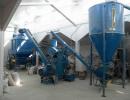
There are dams on the river. One of them is located near the city of Bamako, the second near the town of Sansanding in the Segou region. They serve to raise water into irrigation canal systems. As for the hydroelectric power station, there is one in Nigeria with a design capacity of 960 MW. There is a Kainji reservoir near the dam. Its length reaches almost 100 km, and its area is 600 square meters. km.
The West African Stream is considered to be relatively clean. In the ocean, the Niger River carries tens of times less precipitation than the Nile. This is explained by the presence of rocks that produce a minimum of silt. In general, it should be noted that the river is of great economic importance for West Africa. There are projects for the construction of dams and hydroelectric power plants. Their implementation depends only on finances. There is always not enough money, and therefore the work is stretched for a long period of time.
Stanislav Lopatin